Google Maps is a Web-based tool that provides precise information on geographical regions and sites worldwide. Aside from traditional road maps, Google Maps provides aerial and satellite views of numerous locations. Google Maps in certain cities provides street views comprised of images shot from automobiles.. Google Maps is not just a useful tool for exploring a new region, but it also includes a secret feature that transforms it into a time machine. While you can’t alter the past, you may browse Google Maps’ Street View picture collection to get a sense of what your surroundings were like in the past. This is a great little function that you should absolutely try if you’re searching for some nostalgia. Here’s how to use Google Maps to travel back in time.
- To begin, open Google Maps on your computer and then go to Street View.
- Drag the yellow figure (pegman) in the lower right corner onto any roadway to do this. The streets will flash blue if you grab them, indicating where you should drop them.
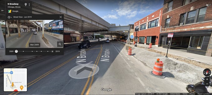
- If you’re using Street View, look in the top-left corner of the window. Here you’ll find a brief description of your current location, as well as a Street View, a month, and a year.
- When you click it, a timeline with several dots appears. You may view what the site looked like at different points over the last decade or so by dragging the grey circle ahead or backward.
- After you’ve gone back to your selected visit date, click on the image to go back in time with Street View.

However, not every location will be the same. During our testing, we discovered that certain areas, such as New York’s Time Square, had over a dozen spots to return to, while others just had a handful or none. The greatest roads to visit are generally in cities, whereas dead ends and off-the-beaten-path routes have only been caught once or twice – if you’re lucky.
For more such updates keep reading on Techinnews


